Updated and expanded on 24 August and 2 September 2014 with additional information.
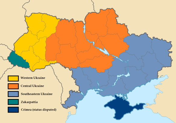
Given all the discussion about Ukraine’s regional divisions, I thought that it might be useful for observers if I gave a quick overview of the historical geography of Ukraine by the larger regions within the country. This may help sort out the uses and abuses of history in the ongoing Ukraine crisis.
Western Ukraine:
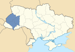
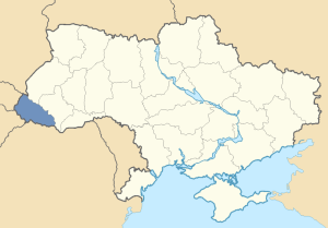
Galicia:
- Contemporary regions: Lviv, Ternopil, and Ivano-Frankivsk oblasti
- Major cities and towns: Lviv, Ternopil, and Ivano-Frankivsk
- Notes: Part of Austria-Hungary and then interwar Poland before becoming part of the USSR. It must be emphasized that this region was never part of the Russian Empire, though it was a principality of the old Kievan Rus’.
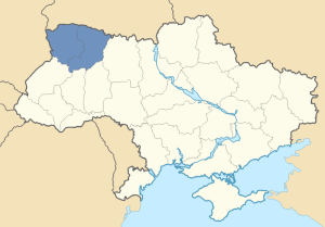
Volhynia:
- Contemporary area: Volhyn and Rivne oblasti
- Major cities and towns: Lutsk and Rivne
- Notes: Part of the Russian Empire and then interwar Poland before becoming part of the USSR.
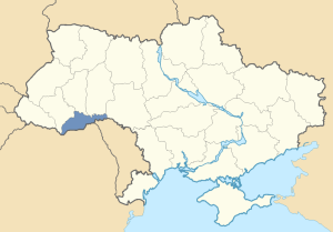
Northern Bukovina and Northern Bessarabia:
- Contemporary area: Chernvisti oblast
- Major cities and towns: Chernvisti and Khotyn
- Notes: Though geographically part of the West, this region has voting and linguistic patterns that are similar those found in Central Ukraine. The locals largely speak the mixed Russian-Ukrainian language Surzhyk (spoken by most in Central Ukraine) and elections here are very close. There is also a large Romanian minority (about 20% of the total population) which plays an additional factor in the region’s politics. The area was part of the interwar Kingdom of Romania and Romanian nationalists in Bucharest still claim the region as rightfully their’s.
Carpathian Rus’, also known as Subcarpathian Rus’ or Transcarpathian Rus’:
- Contemporary area: Zakarpattia oblast
- Major cities and towns: Uzhgorod, Mukachevo, Khust, and Rakhiv
- Notes: Part of the Kingdom of Hungary within Austria-Hungary and then part of interwar Czechoslovakia before becoming part of the USSR. The homeland of the Carpatho-Rusyns, Carpathian Rus’ is sometimes considered its own distinct region due to its unique ethnic, linguistic, and cultural character. There is also a 12% Hungarian minority in this region. Hungarian nationalists in Budapest who refuse to recognize the 1920 Treaty of Trianon still claim the region as rightfully their’s.
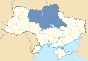
Central Ukraine:
Dnieper Ukraine:
- Contemporary area: Most of the Central oblasti of Ukraine, particularly the Kiev, Cherkasy, Poltava, and Zhytomyr oblasti.
- Major cities and towns: Kiev, Cherkasy, Poltava, and Zhytomyr
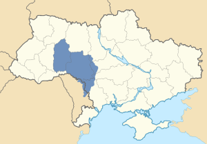
Podolia:
- Contemporary area: All of the Vinnitsyia and Khmelnytskyi oblasti, with the southwesternmost parts of the Kiev oblast, the westernmost parts of the Cherkasy oblast, the northern portions of the Odessa oblast, and the northern parts of the breakaway region of Transnistria in Moldova.
- Major cities and towns: Vinnitsyia, Khmelnytskyi, Kamianets-Podilskyi, and Rybnitsa
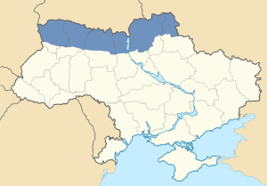
Polesia:
- Contemporary area: Northern parts of the Zhytomyr, Kiev, Chernihiv, and Sumy oblasti, sometimes including the northern parts of Volhynia too.
- Major cities and towns: Chernihiv, Shostka, Nizhyn, and Korosten
Southeastern Ukraine:
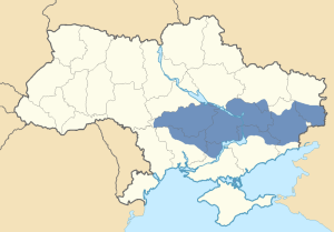
Zaporozhia:
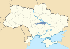
- Contemporary area: The core territory of this region encompassed the Dnipropetrovsk oblast, the northern portions of the Zaporozhia oblast, and virtually all of the Central Ukrainian oblast of Kirovograd. Additionally, it included the very small southernmost portion of the Poltava oblast south of the Dnieper River, around the southern side of the industrial city of Kremenchuk. Zaporozhia also extended east to include parts of the Kharkiv, Donetsk and Luhansk oblasti and south to include the northernmost portions of the Nikolayev and Kherson oblasti.
- Major cities and towns: Dnipropetrovsk, Zaporozhia, Kryvyi Rih, and Kirovograd
- Notes: The word “porozh” in Ukrainian and Russian indicates “rapids” so the name literally means “land beyond the rapids” (referring to the rapids of the river Dnieper).
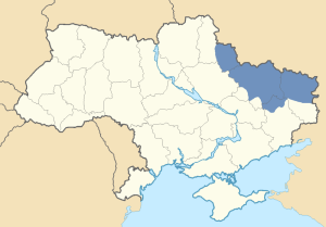
Sloboda Ukraine (Free Ukraine), also known as Sloboda Zemlya (Free Land) or Slobozhanshchina:
- Contemporary area: Almost all of the Kharkiv oblast, except for the southernmost parts. Also included were the southern portions of the Central Ukrainian Sumy oblast, the northernmost portions of the Donetsk oblast, and the areas of the Luhansk oblast north of the Seversky Donets river.
- Major cities and towns: Kharkiv, Sumy, Izyum, and Starobilsk
- Notes: The Tsarist-era Kharkov guberniya approximately corresponds to the boundaries of Sloboda Ukraine. According to the Tsarist census of 1897, the guberniya’s population was majority ethnic “Little Russian” (i.e., Ukrainian). Also, until 1939, the city of Sumy and the southern portions of the modern-day Sumy oblast were part of the Soviet-era Kharkov oblast.
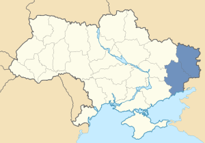
The Donbas:
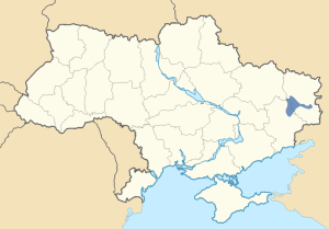
- Contemporary area: The Donetsk and Luhansk oblasti (also the breakaway “People’s Republics” of Donetsk and Luhansk).
- Major cities and towns: Donetsk, Luhansk, Mariupol, Slavyansk, and Kramatorsk
- Notes: The name is short for “Donets Basin.” In Tsarist times, the Donbas region was administratively divided. The northern portions of both oblasti were part of the Kharkov guberniya (the historic Sloboda Ukraine), while their western portions were part of the Yekaterinoslav guberniya (the eastern part of historic Novorossiya), and their eastern portions were part of the Don Host Oblast which also included significant portions of Southern Russia. Due to the latter fact, some might argue that the eastern Donbas was once “part of Russia.” However, such an argument is problematic because, in this region, the distinction between what is “Russian” and what is “Ukrainian” becomes increasingly blurred. For instance, this area between Russia and Ukraine is so demographically mixed that some Ukrainians might conversely claim parts of Southern Russia as “Ukrainian.” The blurriness is compounded by the fact that the Cossacks who historically lived in these areas were not from an exclusive national group. They were both Russians and Ukrainians.
Crimea, also known as Taurida:
- Contemporary area: The Republic of Crimea and the Federal City of Sevastopol administered by Russia, the Autonomous Republic of Crimea and the City of Sevastopol, claimed by Ukraine.
- Major cities and towns: Sevastopol, Simferopol, Kerch, Feodosiya, and Yalta
- Notes: In addition to the Crimean peninsula, the Tsarist-era Taurida guberniya also included significant portions of the modern Kherson and Zaporozhia oblasti in contemporary Ukraine. However, this “mainland” part of the guberniya (also considered to be part of “Novorossiya proper”) significantly differed demographically from the peninsula. According to the 1897 Tsarist census, the mainland’s population was primarily “Little Russian” (Ukrainian) with a significant “Great Russian” (ethnic Russian) minority, while the population of the peninsula was largely “Great Russian” and Tatar with a significant Ukrainian minority and additional ethnic minorities of Germans, Jews, Bulgarians, Greeks, Armenians, Poles, and others.
The Budzhak:
- Contemporary area: Portion of the Odessa oblast situated south of Moldova, east of Romania and the Danube, and west of the Dniester, on the Black Sea coast.
- Major cities and towns: Izmail and Bilhorod-Dnistrovskyi (Akkerman)
- Notes: Historically the southernmost part of Bessarabia, this region was part of the interwar Kingdom of Romania until it was annexed by the Soviet Union in 1940. In Soviet Ukraine, it was administered as the Akkerman oblast, later renamed the Izmail oblast. In 1954, the oblast was abolished and incorporated into the Odessa oblast. A multiethnic region, the Budzhak is majority Ukrainian with substantial Bulgarian, Russian, Romanian, and Gagauz minorities. The name “Budzhak” is derived from the Turkish word “bucak,” meaning “district” or “corner.”
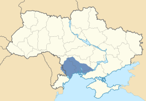
The Yedisan:
- Contemporary area: The southern portions of Transnistria and the Odessa oblast (excluding the Budzhak), the southern portion of the Nikolayev oblast, and the southwestern portion of the Kherson oblast.
- Major cities and towns: Odessa, Nikolayev, and Tiraspol
- Notes: The name “Yedisan” (alternatively transliterated as “Edisan” or “Jedisan”) is derived from a nomadic Nogai Turkic tribe who once inhabited this area. It literally means “seven titles” referring to seven different subdivisions among the tribe. In the 18th century, the region was incorporated into Imperial Russia by Catherine the Great as part of Novorossiya and settled by Ukrainians (Malorussians), Russians, and others. The area was also known as “Ochakov Tartary” after the historic fortress of Ochakov located in the contemporary Nikolayev oblast.
Novorossiya (New Russia):
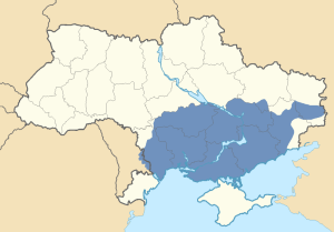
- Contemporary area: The Nikolayev and Kherson oblasti, the southern portions of Transnistria and the Odessa oblast (excluding the Budzhak), the southern part of the Zaporozhia oblast, the southeasternmost area of the Kharkiv oblast, the Western half of the Donbas (including the cities of Donetsk and Luhansk), and most of the historical region of Zaporozhia. Novorossiya also occasionally included Bessarabia (Moldova proper with the Budzhak region of the Odessa oblast), Crimea, and the Don Host Oblast (the eastern half of the Donbas and significant portions of Southern Russia).
- Major cities and towns: Odessa, Nikolayev, Kherson, Tiraspol, and Berdyansk
- Notes: It must be emphasized that, with the exception of its southeasternmost area, much of the territory of the modern-day Kharkiv oblast was not part of Novorossiya. Further the majority population of the core territory of Novorossiya (Odessa, Nikolayev, Kherson, southern Transnistria, western Donbas, and historic Zaporozhia) in the 1897 Tsarist census were identified as ethnic “Little Russians” (Ukrainians) with significant minorities of “Great Russians” (ethnic Russians) and, in the Odessa area, Jews. Consequently, the idea of making this region a part of Soviet Ukraine was logical from a geographic and ethnographic standpoint. Thus, it must be emphasized that the assignment of these territories was not a “great mistake” by the Bolsheviks as Russian President Vladimir Putin, Russian Deputy Prime Minister Dmitry Rogozin and others have been claiming. Indeed, it is likely that Putin is advancing the Novorossiya claim to placate hardliners like Rogozin in the Kremlin who want to invade Southeastern Ukraine and are attempting to use historical revisionism to show that the region is “another Crimea” in order to justify such actions. However, no invasion can be justified and would be a disaster for both Russia and Ukraine.
Novaya Serbiya (New Serbia):
- Contemporary area: Northern portions of the Kirovograd oblast, with some adjoining areas of the neighboring Cherkasy, Poltava, and Dnipropetrovsk oblasti.
- Major cities and towns: Novomyrgorod
- Notes: Founded by Tsarist Russia as a military frontier with Poland in the 1750s populated by Serbs, Montenegrins, Romanians, and others from Habsburg Austria (hence the name). The territory was later abolished in 1764 and incorporated into Novorossiya.
Slavo-Serbiya (Slavo-Serbia):
- Contemporary area: Border regions between the modern-day Donetsk and Luhansk oblasti.
- Major cities and towns: Artemivsk (Bakhmut)
- Notes: Founded by Tsarist Russia as a refuge for Serbs, Montenegrins, Romanians, Bulgarians, Hungarians, Greeks, and others. The territory was later abolished in 1764 and incorporated into Novorossiya.
For more information on Ukraine’s diverse regional divisions, see my earlier post, What is Ukraine? from March here, now updated and expanded to include the latest information about Ukraine.



Pingback: RUSSIA & UKRAINE: JRL 2014-#109 contents with links :: Sunday 18 May 2014 | Johnson's Russia List
You should’ve pointed out the main cities to make it clear where certain districts are whithin the regions.
Excellent idea! I’ve revised my piece to specify the major cities as well.
Pingback: Between East and West: The Curious Case of Kirovograd | Reconsidering Russia and the Former Soviet Union
Pingback: 10 Points on the People of Southeastern Ukraine | Reconsidering Russia and the Former Soviet Union
Pingback: Ukraine: Where Nation-Building and Empire Meet | Reconsidering Russia and the Former Soviet Union
Pingback: L’affaire Stephen F. Cohen and Academic Dissent and Division on Ukraine | Reconsidering Russia and the Former Soviet Union
Was not Vodolaga within Novorossiya (1764)?
You mean Vodolaga in Kharkiv Oblast? No, it never extended that far north.